|
About
the Institute
Brief
History
Maps
Acts
Indo-French
& Cultural Centre
Library
French
Language Study
Scope
of Higher Education in French
Organisation
& committee
Visits
of V.I.P.s
Picture
Gallery
News
Home |
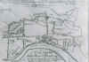
Map of
River Hooghly with European Setlements (c 17th Century , A.D.)
|
 |
 |
|
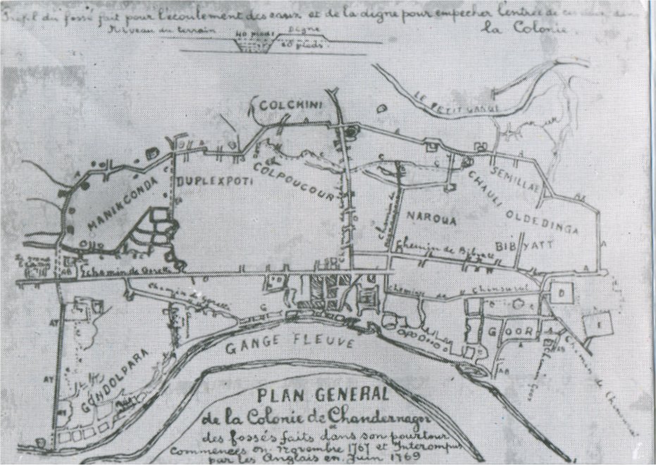
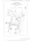
| Plan Map of Chandennagor, 17th Century. |
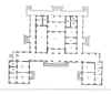
Map of Duplex House |
Ground
Floor |
First
Floor |
|
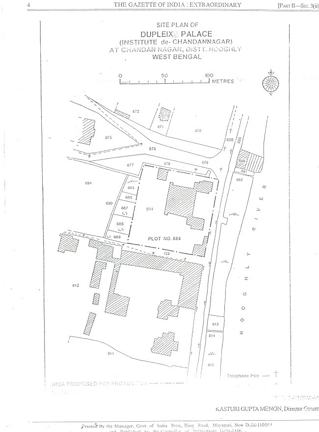
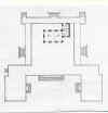
Site Plan of Institute De Chandennagore |
Details of Ground Floor
|
1.
French East India gallery.
|
11.
Store and Electric meter.
|
|
2.
French furniture gallery.
|
12.
Museum Store.
|
|
3. French
Administration of Chandernagore.
|
13.
Lavatory.
|
|
4.
Dupleix gallery.
|
14.
Staircase.
|
|
5.
Freedom of Chandernagore gallery.
|
15.
Store.
|
|
6.
Indian Freedom Movement and Tagore.
|
16.
Office.
|
|
7.
Paintings.
|
17.
Library.
|
|
8.
Handicrafts and Terracotta.
|
18.
Library.
|
|
9.
Coin and Ivory.
|
19.
Library.
|
|
10.
School of Painting, Chandernagore.
|
20.
Library.
|
|
|
21.
Computer Room.
|
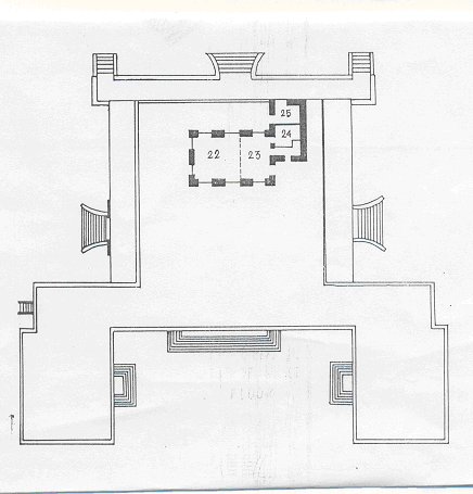
Details of First Floor
|
22.
Rare old books store.
|
|
23. Preservation
Lavatory.
|
|
24. Lavatory Store
Room.
|
|
25. Lavatory.
|
|
|

|
|
|